Map view
From Kerbal Space Program Wiki
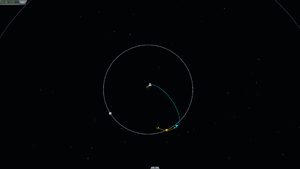
The Map View is the secondary screen view mode used whilst on a mission. It shows projections of the trajectories of vessels and celestial bodies. It provides mission-critical information about
- Current altitude, position and speed of your vessel
- Altitude, position and time of apoapsis and periapsis of your vessel's trajectory
- Encounters with the spheres of influence of celestial bodies, as well as the vessels' trajectory within said spheres
Draw Mode
Altering the PATCHED_CONIC_DRAW_MODE setting in the settings.cfg will change the way trajectories are shown in the Map View
- 0 - Local to Body: Patches are drawn in relation to the current position of each orbiting body.
- 1 - Local at SOI Entry UT (default): Patches are drawn in relation to the body, but at the time of SOI entry.
- 2 - Local at SOI Exit UT: Same as 1 but at the time of leaving the SOI.
- 3 - Relative(continuous line mode): Patches are drawn in relation to the current body being orbited.
- 4 - Dynamic: An experimental mode blending trajectory lines relative to the local and parent body
Further explanation of the Draw Modes can be found in this video
