Difference between revisions of "Category:Topographical maps"
From Kerbal Space Program Wiki
(Created page with "Category for topographical maps, mostly generated with the ISA MapSat plugin. Category:Images of celestial bodies") |
m (+false-color category;) |
||
| Line 2: | Line 2: | ||
[[Category:Images of celestial bodies]] | [[Category:Images of celestial bodies]] | ||
| + | [[Category:False-color maps]] | ||
Latest revision as of 13:42, 23 December 2013
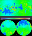
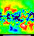
Category for topographical maps, mostly generated with the ISA MapSat plugin.
Media in category "Topographical maps"
The following 18 files are in this category, out of 18 total.
- Bop 800 map.gif 377 KB
- Dres map 800.gif 416 KB
- Dres Topo 0-5669.4m.jpg 438 KB
- Duna map 800.gif 471 KB
- Eeloo map 800.gif 424 KB
- Eve isa scan.png 310 KB
- Eve map 800.gif 440 KB
- Gilly map 800.gif 341 KB
- Ike map 800.gif 388 KB
- Isa mapsat mun map800.gif 430 KB
- Kerbin map 800.gif 373 KB
- Laythe map 800.gif 438 KB
- Minmus 800.gif 495 KB
- Moho 800 map.gif 435 KB
- Pol 800 map.gif 406 KB
- Tylo map 800.gif 575 KB
- Vall 800 map.gif 456 KB


