Search results
Create the page "A" on this wiki! See also the search results found.
Page title matches

File:A Kerbal on the Mun.jpeg A Kerbal on the Mun with his ship, flag, and Kerbin in the background.(1,366 × 768 (98 KB)) - 18:57, 24 January 2020
File:A gamepad mapping for KSP.png (1,052 × 648 (249 KB)) - 01:34, 25 October 2013
File:A class asteroid.jpg Class A asteroid with probes providing [[RCS]] attached.(1,600 × 900 (179 KB)) - 18:30, 16 April 2014
File:A Rover with 4 Kerbals.png A rover on the [[Runway]] with 4 manned [[Kerbal|kerbals:]] [[Jebediah Kerman(376 × 297 (188 KB)) - 18:58, 24 January 2020
File:AdvancedNoseCone-A White.png (200 × 200 (28 KB)) - 15:14, 27 December 2018
File:AdvancedNoseCone-A Gray.png (200 × 200 (28 KB)) - 15:14, 27 December 2018
File:AdvancedNoseCone-A Orange.png (200 × 200 (26 KB)) - 15:14, 27 December 2018
File:A-Class Asteroid Wrangling.jpeg (1,120 × 630 (128 KB)) - 00:42, 30 March 2023
Page text matches
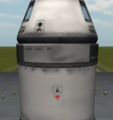
File:ASAS Large.png Large ASAS module example in a rocket.(400 × 426 (104 KB)) - 00:34, 5 November 2022
File:Bob Kerman.gif ...nly already existing thumbnails can be used. It won't create thumbnails of a non-existing size, therefore use [[:File:Bob Kerman.png]] instead.(71 × 71 (4 KB)) - 19:01, 25 August 2014
File:Kerbal on Gilly's surface.png A [[kerbonaut]] on [[EVA]] on [[Gilly]].(1,920 × 1,080 (734 KB)) - 12:23, 17 April 2014
File:Polar.gif A polar co-ordinate system.(278 × 351 (3 KB)) - 18:57, 7 April 2013
File:Isa mapsat mun map800.gif A topografic height map of the mun made with the ISA MapSat plugin(1,009 × 1,361 (430 KB)) - 12:36, 22 July 2014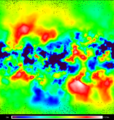
File:Minmus Topo mercator 400x400.png A topographic map of Minmus made with the "ISA MapSat - Satellite mapping mod(400 × 420 (272 KB)) - 12:36, 22 July 2014
File:Jool.jpg A picture of gas giant Jool.(473 × 471 (22 KB)) - 18:51, 17 May 2016
File:Kerbal at Jools surface.png A [[kerbonaut]] "landed" on [[Jool]].(1,024 × 768 (48 KB)) - 12:43, 3 February 2014
File:Duna Topo ISA 3200x1600 compressed.png Fairly complete, but has a few black pixels here and there.(3,200 × 1,600 (1.72 MB)) - 20:02, 27 September 2012
File:DunaRocket.jpg ...espite having no middle stage it can reach Duna, and return to Kerbin with a little piloting skill.(1,366 × 768 (129 KB)) - 23:22, 7 October 2012
File:Atmosphere kerbin duna.png A graph comparing the atmospheric pressures of Kerbin and Duna.(640 × 480 (7 KB)) - 10:11, 18 April 2014
File:Atmosphere kerbin eve.png A graph comparing the atmospheric pressures of Kerbin and Eve.(640 × 480 (6 KB)) - 10:10, 18 April 2014
File:KerbolSurface.png A picture taken of a probe on a close encounter with Kerbol shortly before overheating.(1,366 × 768 (137 KB)) - 05:45, 8 March 2015
File:Vall-landscape.png A crew of Kerbonauts enjoying the view over Valls landscape.(1,341 × 862 (392 KB)) - 16:31, 25 March 2013
File:Vall-rock.png A rock on Vall(959 × 672 (580 KB)) - 16:32, 25 March 2013
File:Duna map 800.gif A topografic height map of Duna made with the ISA MapSat plugin(1,009 × 1,361 (471 KB)) - 12:36, 22 July 2014
File:Ike map 800.gif A topografic height map of Ike made with the ISA MapSat plugin(1,009 × 1,361 (388 KB)) - 12:36, 22 July 2014
File:Eve map 800.gif A topografic height map of Eve made with the ISA MapSat plugin(1,009 × 1,361 (440 KB)) - 12:36, 22 July 2014
File:Bop 800 map.gif A topografic height map of Bop made with the ISA MapSat plugin(1,009 × 1,361 (377 KB)) - 12:37, 22 July 2014
File:Kerbin map 800.gif A topographic heightmap of Kerbin made with the ISA MapSat plugin(1,009 × 1,361 (373 KB)) - 12:36, 22 July 2014