Search results
Create the page "Topographical maps" on this wiki! See also the search results found.

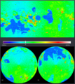
File:Gilly map 800.gif [[Category:Topographical maps]](1,009 × 1,361 (341 KB)) - 12:38, 22 July 2014
File:Laythe map 800.gif [[Category:Topographical maps]](1,009 × 1,361 (438 KB)) - 12:38, 22 July 2014- Category for topographical maps, mostly generated with the ISA MapSat plugin. [[Category:False-color maps]]18 members (0 subcategories, 18 files) - 13:42, 23 December 2013

File:Eve isa scan.png [[Category:Topographical maps]](416 × 465 (310 KB)) - 17:04, 15 September 2014- ...it is the last island before a large expanse of ocean. If you look at the topographical map on the [[Laythe]] page there is a peninsula at approximately 165°W ...ther factors (basically I rounded up to the nearest 100 m/s). The Δv maps on the [[Cheat sheet]] page is helpful in building the budget, though they31 KB (5,464 words) - 17:09, 14 November 2022