Difference between revisions of "List of bases on Kerbin"
(Added section and information about Cove Launch Site.) |
RocketsRus (talk | contribs) (→Harvester Massif) |
||
| (48 intermediate revisions by 18 users not shown) | |||
| Line 3: | Line 3: | ||
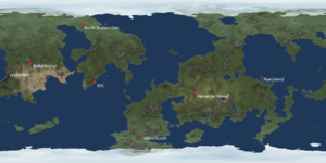
[[File:KerbinBases1.2.png|thumb|Map of relay stations/bases around Kerbin as of 1.2.]] | [[File:KerbinBases1.2.png|thumb|Map of relay stations/bases around Kerbin as of 1.2.]] | ||
| − | This is a list of relay stations/bases on Kerbin that are currently in 1.12.0 Note: only the Kerbal Space Center is an operational base (without Making History) whilst the rest can only be visited. | + | This is a list of relay stations/bases on Kerbin that are currently in 1.12.0 Note: only the Kerbal Space Center is an operational base (without Making History) whilst the rest can only be visited. There are some launch sites/bases that can be used for rocket launches once they have been discovered by driving near them or flying directly over them. |
| − | + | ||
== Kerbal Space Center == | == Kerbal Space Center == | ||
| Line 13: | Line 13: | ||
== Island Airfield == | == Island Airfield == | ||
[[File:Insular KSC hangars.png|thumb|The buildings in the central area of the airfield.]] | [[File:Insular KSC hangars.png|thumb|The buildings in the central area of the airfield.]] | ||
| − | [[Island Airfield]] is an abandoned strip of land just to the east of the Kerbal Space center. It has a short runway which can make it challenging to land on, aside | + | [[Island Airfield]] is an abandoned strip of land just to the east of the Kerbal Space center. It has a short runway which can make it challenging to land on, aside from the fact that some of the land around the runway is raised to the same level which gives some space if the plane doesn't land exactly on the runway strip. In one of the hangers are some very old parts from pre-0.18 with an over-sized Mk1 capsule. It is possible to launch aircraft from here with, but versions before 1.12 require Making History DLC to do so. |
{{clear}} | {{clear}} | ||
== Inland Kerbal Space Center == | == Inland Kerbal Space Center == | ||
| + | {{spoiler}} | ||
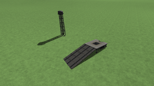
[[File:Inland KSC launch pad and VAB.png|thumb|The VAB and the Launch Pad shown.]] | [[File:Inland KSC launch pad and VAB.png|thumb|The VAB and the Launch Pad shown.]] | ||
| − | The [[Inland Kerbal Space Center]], (also known as KSC2, officially Baikerbanur) is | + | The [[Inland Kerbal Space Center]], (also known as KSC2, officially Baikerbanur) is a second space center made of some pre-0.19 KSC buildings, although it was created in 0.14.2. There is no SPH or runway. At {{Kerbalmaps|20.6622|-146.4603|text=C}}, it is very far from the [[Kerbal Space Center]] and can only be reached by airplanes with a lot of fuel and/or efficient engines. It can also be reached by rockets. |
{{clear}} | {{clear}} | ||
| − | == Woomerang Launch Site == | + | == Making History DLC Launch Sites == |
| + | The Making History DLC brought 2 additional launch sites. The Woomerang Launch Site and the Dessert Launch Complex. | ||
| + | |||
| + | === Woomerang Launch Site === | ||
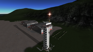
[[File:WoomerangLaunchSite.png|thumb|The Launch Pad and its water tower.]] | [[File:WoomerangLaunchSite.png|thumb|The Launch Pad and its water tower.]] | ||
The [[Woomerang Launch Site]] is a relatively austere launch site located in Kerbin's northern hemisphere, added in Making History 1.0. Contains a launch pad in a somewhat different style from that at KSC and a water tower. The site is called Larkes in CommNet. | The [[Woomerang Launch Site]] is a relatively austere launch site located in Kerbin's northern hemisphere, added in Making History 1.0. Contains a launch pad in a somewhat different style from that at KSC and a water tower. The site is called Larkes in CommNet. | ||
{{clear}} | {{clear}} | ||
| − | == Dessert Launch Complex == | + | === Dessert Launch Complex === |
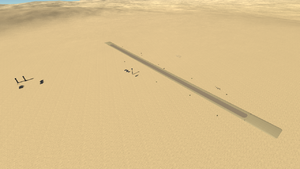
[[File:DessertLaunchComplex.png|thumb|The launch site and runway shown.]] | [[File:DessertLaunchComplex.png|thumb|The launch site and runway shown.]] | ||
| − | Treated ingame as two separate sites, the Dessert Launch Complex features both a [[Dessert Launch Site|launch pad]] and [[Dessert Airfield|runway]], located within the "western desert" region. The name is a pun developed by snack obsessed Kerbals. | + | Treated ingame as two separate sites, the Dessert Launch Complex features both a [[Dessert Launch Site|launch pad]] and [[Dessert Airfield|runway]], located within the "western desert" region. The name is a pun developed by snack obsessed Kerbals. Can only be accessed if you have the Making History DLC. |
| + | {{clear}} | ||
| + | |||
| + | == 1.12 Discoverable Bases == | ||
| + | The 1.12 update brought discoverable bases that could be accessible for use once discovered. A discovery notification also shows up for the base. | ||
| + | |||
| + | These bases may be detected by Kerbnet as anomalies. Vessels on their launch pads can be recovered for 100% of the vessel's value. | ||
| + | |||
| + | === Glacier Lake Launch Site === | ||
| + | {{spoiler}} | ||
| + | [[File:The Glacier Lake Launch Site.png|thumb|A plane flying over the [[Glacier Lake Launch Site]].]] | ||
| + | [[Glacier Lake Launch Site]] is a launch site that has a launch pad and some other decorative buildings such as a water tower and some buildings. The launch site is located near a small lake that is partially covered by a glacier and a tall mountain range. The launch site is also on a steep hill (estimates of around 30 degrees of incline) The launch site can only be used when is it discovered. The [[Glacier Lake Launch Site]] is located at a latitude of 73.56 N : [1.28N] and a longitude of 84.24 E : [1.47E] as read on the Surface Scanning Module, or 73° 33' N, 84° 14' E on the KerbNet panel. | ||
| + | {{clear}} | ||
| + | |||
| + | === Cove Launch Site === | ||
| + | {{spoiler}} | ||
| + | [[File:The Cove Launch Site.png|thumb|The [[Cove Launch Site]] with a small rover]] | ||
| + | The [[Cove Launch Site]] is a launch site that is about 50 kilometers northeast of the [[Kerbal Space Center]] ([[KSC]]). The launch site can be accessed once it has been discovered. The launch site does not require the [[Breaking Ground]] or [[Making History]] DLC. The launch site comes with 3 small buildings, some fuel tanks, a water tank, and a launch pad. The launch pad at this site is the only stock building in contact with seawater. The launch site is located at a latitude of 3.70 and a longitude of -72.20. | ||
| + | {{clear}} | ||
| + | |||
| + | === Mahi Mahi Launch Site === | ||
| + | {{spoiler}} | ||
| + | [[File:The Mahi Mahi Launch Site.png|thumb|A plane flying over the [[Mahi Mahi Launch Site]].]] | ||
| + | [[Mahi Mahi Launch Site]] is a launch site that is on a large island southwest of the [[Kerbal Space Center]]. The launch site can be accessed once it has been discovered. The launch site has 3 small buildings, a water tower, some fuel tanks, and a launch pad. It was added in the 1.12 update, Final Approach. The [[Mahi Mahi Launch Site]] is located at a latitude of -49.80 and a longitude of -120.77. | ||
{{clear}} | {{clear}} | ||
| − | == | + | === Crater Launch Site === |
| − | [[File: | + | {{spoiler}} |
| − | [[ | + | [[File:LocationOfCraterLaunchSiteOnKerbinMap.png|thumb|A plane flying towards the [[Crater Launch Site]]. ]] |
| + | [[Crater Launch Site]] is a launch site that can be accessed when it has been discovered. It does not require the [[Making History]] or [[Breaking Ground]] DLC to find though. It came free along side the 1.12 update, Final Approach, on June 24, 2021. The launch site is located on an island in the middle of [[Kerbin]]'s most pronounced craters on the east side of the island. The launch site is located on a steep slope (of around 30 degrees). Due to the steep incline the launch site cannot have a runway without modifying the terrain. The [[Crater Launch Site]] consist of a small building complex, a launch pad, a water tower, and some fuel tanks. The [[Crater Launch Site]] is located at a latitude of 8.39 and a longitude of -179.68. | ||
{{clear}} | {{clear}} | ||
| − | == | + | ==CommNet Stations== |
| − | The [[ | + | CommNet stations are ground stations to keep in touch with probes, ships, and other crafts. |
| + | |||
| + | === Crater Rim === | ||
| + | {{spoiler}} | ||
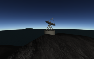
| + | Crater Rim is a relay station located at a latitude of 9.45 and at a longitude of -172.110278. The relay station is located on a mountain range outlining one of [[Kerbin]]'s most pronounced craters. Crater Rim is classified as an anomaly and will appear as a white question mark on [[KerbNet]]. | ||
| + | [[File:Crater Rim.png|thumb|The Crater Rim station with the crater island visible in the background]] | ||
| + | {{clear}} | ||
| + | === Nye Island === | ||
| + | {{spoiler}} | ||
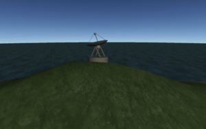
| + | Nye Island is a relay station located on an island and is considered an easter egg because of its name, presumed to be a reference to Bill Nye. Nye Island is located at a latitude of 5.363611 and at a longitude of 108.548056. Nye Island is classified as an anomaly and will appear as a white question mark on [[KerbNet]]. | ||
| + | [[File:Nye Island.png|thumb|The Nye Island CommNet station overlooking the ocean]] | ||
| + | {{clear}} | ||
| + | === Harvester Massif === | ||
| + | {{spoiler}} | ||
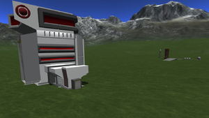
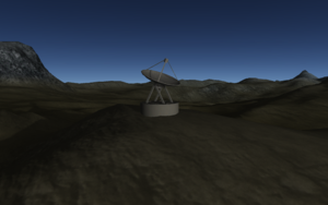
| + | Harvester Massif is a relay station located in the middle of [[Kerbin]]'s largest continent. Probably a reference to HarvesterMassif, a developer of KSP. The relay station is located at a latitude of -11.95 and at a longitude of 33.740278. Harvester Massif is classified as an anomaly and will appear as a white question mark on [[KerbNet]]. | ||
| + | [[File:Harvester_Massif.png|thumb|The Harvester Massif station atop a mountain.]] | ||
| + | {{clear}} | ||
| − | == | + | === North Station One === |
| − | + | {{spoiler}} | |
| + | North Station One is a relay station located near the northern icecaps on [[Kerbin]]. The relay station is located at a latitude of 63.095 and at a longitude of -90.079722. North Station One is classified as an anomaly and will appear as a white question mark on [[KerbNet]]. | ||
| + | [[File:North Station One.png|thumb|The North Station One station (Note that part of the base is clipped out of the mountain)]] | ||
| + | {{clear}} | ||
| + | === Mesa South === | ||
| + | {{spoiler}} | ||
| + | Mesa South is a relay station located south of the equator and east of the [[Kerbal Space Center]] ([[KSC]]). The relay station is located at a latitude of -59.589722 and at a longitude of -25.861667. Mesa South is classified as an anomaly and will appear as a white question mark on [[KerbNet]]. | ||
| + | [[File:Mesa South.png|thumb|The Mesa South station (Note the oddly shaped mountain)]] | ||
| + | {{clear}} | ||
| + | |||
| + | == Location of CommNet Stations == | ||
| + | {{spoiler}} | ||
| + | CommNet stations were added alongside KSP [[1.2]] and the [[1.2]] pre-release. They are used to communicate with satellites, ships, space stations et cetera. | ||
{| class="wikitable" | {| class="wikitable" | ||
| Line 46: | Line 102: | ||
! Name !! Latitude (DMS) || Longitude (DMS) || Latitude (DD) || Longitude (DD) | ! Name !! Latitude (DMS) || Longitude (DMS) || Latitude (DD) || Longitude (DD) | ||
|- | |- | ||
| − | | | + | |Baikerbanur || 20° 40' 45" N || 146° 30' 04" W || 20.679167 || -146.501111 |
|- | |- | ||
|Crater Rim || 09° 27' 00" N || 172° 06' 37" W || 9.45 || -172.110278 | |Crater Rim || 09° 27' 00" N || 172° 06' 37" W || 9.45 || -172.110278 | ||
| Line 54: | Line 110: | ||
|Harvester Massif || 11° 57' 00" S || 33° 44' 25' E || -11.95 || 33.740278 | |Harvester Massif || 11° 57' 00" S || 33° 44' 25' E || -11.95 || 33.740278 | ||
|- | |- | ||
| − | |North Station || 63° 05' 42" N || 90° 04' 47" W || 63.095 || -90.079722 | + | |North Station One|| 63° 05' 42" N || 90° 04' 47" W || 63.095 || -90.079722 |
|- | |- | ||
|Mesa South || 59° 35' 23" S || 25° 51' 42" W || -59.589722 || -25.861667 | |Mesa South || 59° 35' 23" S || 25° 51' 42" W || -59.589722 || -25.861667 | ||
| Line 60: | Line 116: | ||
{{clear}} | {{clear}} | ||
| + | |||
| + | == Location of Discoverable Launch Sites == | ||
| + | {{spoiler}} | ||
| + | Four more launch sites we added alongside the KSP [[1.12]] update, Final Approach, on June 24th, 2021. This was KSP's tenth anniversary. These launch sites cannot be used until they have been "discovered'. You can "discover" these four launch sites by driving near them or flying directly over them. If flying you have to be under ten-thousands meter from sea level. | ||
| + | |||
| + | {| class="wikitable" | ||
| + | |- | ||
| + | ! Name !! Latitude (DD) || Longitude (DD) | ||
| + | |- | ||
| + | | [[Glacier Lake Launch Site]] || 73.561523 N || 84.247471 E | ||
| + | |- | ||
| + | |[[Cove Launch Site]] || 3.747657 || -72.213260 | ||
| + | |- | ||
| + | |[[Mahi Mahi Launch Site]]|| -49.802495 || -120.765901 | ||
| + | |- | ||
| + | |[[Crater Launch Site]] || 8.385973 || -179.697715 | ||
| + | |- | ||
| + | |} | ||
| + | |||
| + | {{clear}} | ||
| + | |||
| + | == Notes == | ||
| + | |||
| + | [[thread:203236|New Launch Sites Location]] | ||
Latest revision as of 01:59, 11 August 2024
This is a list of relay stations/bases on Kerbin that are currently in 1.12.0 Note: only the Kerbal Space Center is an operational base (without Making History) whilst the rest can only be visited. There are some launch sites/bases that can be used for rocket launches once they have been discovered by driving near them or flying directly over them.
Contents
Kerbal Space Center
The Kerbal Space Center is where everything is managed, from launching rockets to sacrificing kerbals to the Kraken. It's the only operational base on Kerbin that has destructible buildings that will require costs to fix. Players will launch from here and return home to Kerbin and will be greeted by the recovery screen with the movable map of the KSC in the background.
Island Airfield
Island Airfield is an abandoned strip of land just to the east of the Kerbal Space center. It has a short runway which can make it challenging to land on, aside from the fact that some of the land around the runway is raised to the same level which gives some space if the plane doesn't land exactly on the runway strip. In one of the hangers are some very old parts from pre-0.18 with an over-sized Mk1 capsule. It is possible to launch aircraft from here with, but versions before 1.12 require Making History DLC to do so.
Inland Kerbal Space Center
The Inland Kerbal Space Center, (also known as KSC2, officially Baikerbanur) is a second space center made of some pre-0.19 KSC buildings, although it was created in 0.14.2. There is no SPH or runway. At 20° 39′ 43″ N 146° 27′ 37″ W, it is very far from the Kerbal Space Center and can only be reached by airplanes with a lot of fuel and/or efficient engines. It can also be reached by rockets.
Making History DLC Launch Sites
The Making History DLC brought 2 additional launch sites. The Woomerang Launch Site and the Dessert Launch Complex.
Woomerang Launch Site
The Woomerang Launch Site is a relatively austere launch site located in Kerbin's northern hemisphere, added in Making History 1.0. Contains a launch pad in a somewhat different style from that at KSC and a water tower. The site is called Larkes in CommNet.
Dessert Launch Complex
Treated ingame as two separate sites, the Dessert Launch Complex features both a launch pad and runway, located within the "western desert" region. The name is a pun developed by snack obsessed Kerbals. Can only be accessed if you have the Making History DLC.
1.12 Discoverable Bases
The 1.12 update brought discoverable bases that could be accessible for use once discovered. A discovery notification also shows up for the base.
These bases may be detected by Kerbnet as anomalies. Vessels on their launch pads can be recovered for 100% of the vessel's value.
Glacier Lake Launch Site
Glacier Lake Launch Site is a launch site that has a launch pad and some other decorative buildings such as a water tower and some buildings. The launch site is located near a small lake that is partially covered by a glacier and a tall mountain range. The launch site is also on a steep hill (estimates of around 30 degrees of incline) The launch site can only be used when is it discovered. The Glacier Lake Launch Site is located at a latitude of 73.56 N : [1.28N] and a longitude of 84.24 E : [1.47E] as read on the Surface Scanning Module, or 73° 33' N, 84° 14' E on the KerbNet panel.
Cove Launch Site

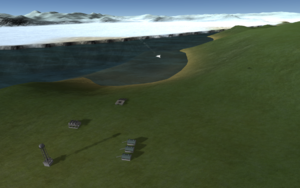
The Cove Launch Site is a launch site that is about 50 kilometers northeast of the Kerbal Space Center (KSC). The launch site can be accessed once it has been discovered. The launch site does not require the Breaking Ground or Making History DLC. The launch site comes with 3 small buildings, some fuel tanks, a water tank, and a launch pad. The launch pad at this site is the only stock building in contact with seawater. The launch site is located at a latitude of 3.70 and a longitude of -72.20.
Mahi Mahi Launch Site

Mahi Mahi Launch Site is a launch site that is on a large island southwest of the Kerbal Space Center. The launch site can be accessed once it has been discovered. The launch site has 3 small buildings, a water tower, some fuel tanks, and a launch pad. It was added in the 1.12 update, Final Approach. The Mahi Mahi Launch Site is located at a latitude of -49.80 and a longitude of -120.77.
Crater Launch Site

Crater Launch Site is a launch site that can be accessed when it has been discovered. It does not require the Making History or Breaking Ground DLC to find though. It came free along side the 1.12 update, Final Approach, on June 24, 2021. The launch site is located on an island in the middle of Kerbin's most pronounced craters on the east side of the island. The launch site is located on a steep slope (of around 30 degrees). Due to the steep incline the launch site cannot have a runway without modifying the terrain. The Crater Launch Site consist of a small building complex, a launch pad, a water tower, and some fuel tanks. The Crater Launch Site is located at a latitude of 8.39 and a longitude of -179.68.
CommNet Stations
CommNet stations are ground stations to keep in touch with probes, ships, and other crafts.
Crater Rim
Crater Rim is a relay station located at a latitude of 9.45 and at a longitude of -172.110278. The relay station is located on a mountain range outlining one of Kerbin's most pronounced craters. Crater Rim is classified as an anomaly and will appear as a white question mark on KerbNet.
Nye Island
Nye Island is a relay station located on an island and is considered an easter egg because of its name, presumed to be a reference to Bill Nye. Nye Island is located at a latitude of 5.363611 and at a longitude of 108.548056. Nye Island is classified as an anomaly and will appear as a white question mark on KerbNet.
Harvester Massif
Harvester Massif is a relay station located in the middle of Kerbin's largest continent. Probably a reference to HarvesterMassif, a developer of KSP. The relay station is located at a latitude of -11.95 and at a longitude of 33.740278. Harvester Massif is classified as an anomaly and will appear as a white question mark on KerbNet.
North Station One
North Station One is a relay station located near the northern icecaps on Kerbin. The relay station is located at a latitude of 63.095 and at a longitude of -90.079722. North Station One is classified as an anomaly and will appear as a white question mark on KerbNet.
Mesa South
Mesa South is a relay station located south of the equator and east of the Kerbal Space Center (KSC). The relay station is located at a latitude of -59.589722 and at a longitude of -25.861667. Mesa South is classified as an anomaly and will appear as a white question mark on KerbNet.
Location of CommNet Stations
CommNet stations were added alongside KSP 1.2 and the 1.2 pre-release. They are used to communicate with satellites, ships, space stations et cetera.
| Name | Latitude (DMS) | Longitude (DMS) | Latitude (DD) | Longitude (DD) |
|---|---|---|---|---|
| Baikerbanur | 20° 40' 45" N | 146° 30' 04" W | 20.679167 | -146.501111 |
| Crater Rim | 09° 27' 00" N | 172° 06' 37" W | 9.45 | -172.110278 |
| Nye Island | 05° 21' 49" N | 108° 32' 53" E | 5.363611 | 108.548056 |
| Harvester Massif | 11° 57' 00" S | 33° 44' 25' E | -11.95 | 33.740278 |
| North Station One | 63° 05' 42" N | 90° 04' 47" W | 63.095 | -90.079722 |
| Mesa South | 59° 35' 23" S | 25° 51' 42" W | -59.589722 | -25.861667 |
Location of Discoverable Launch Sites
Four more launch sites we added alongside the KSP 1.12 update, Final Approach, on June 24th, 2021. This was KSP's tenth anniversary. These launch sites cannot be used until they have been "discovered'. You can "discover" these four launch sites by driving near them or flying directly over them. If flying you have to be under ten-thousands meter from sea level.
| Name | Latitude (DD) | Longitude (DD) |
|---|---|---|
| Glacier Lake Launch Site | 73.561523 N | 84.247471 E |
| Cove Launch Site | 3.747657 | -72.213260 |
| Mahi Mahi Launch Site | -49.802495 | -120.765901 |
| Crater Launch Site | 8.385973 | -179.697715 |
